Hutt River Trail closures
Information on this page was last updated on 26 Feburary 2026.
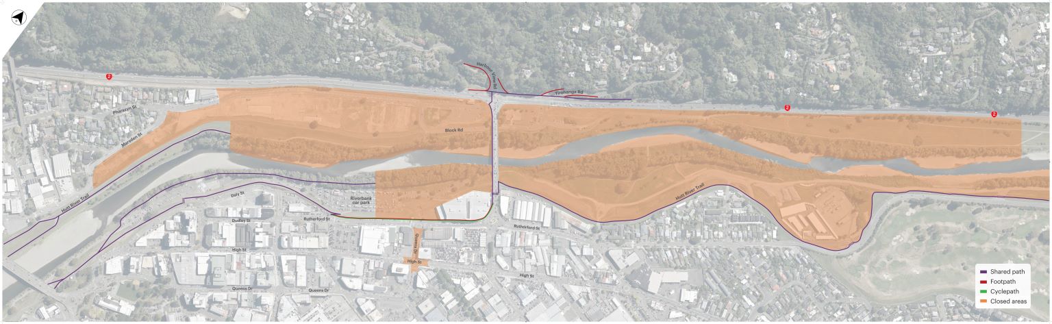
Hutt River Trail path update
As part of building the new SH2 interchange at Melling and other programme works, we have temporarily changed the Hutt River Trail route.
The below map shows the paths that are currently open.
Regular updates will be posted on our Facebook page.