Kawepūrongo
News
Te Wai Takamori o Te Awa Kairangi Community Update 19: May 2025
Newsletters, 16 May 2025Shaping the river, protecting the land, preparing for the future
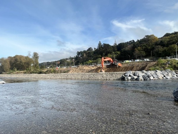
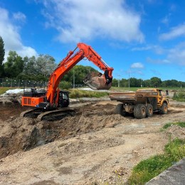
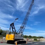
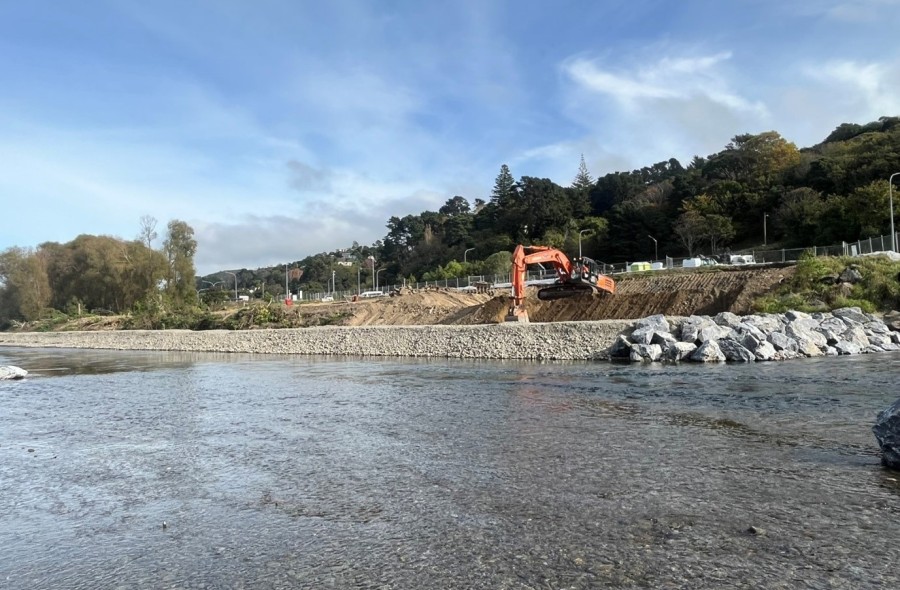
Exciting progress is being made at Tirohanga/Block Road in Melling, where Greater Wellington is continuing work on the installation of rocklines and rock groynes along Te Awa Kairangi / Hutt River.
But what are rocklines and rock groynes — and why are they needed?
Rocklines are carefully placed arrangements of large rocks that run along the riverbank, and rock groynes extend into the river channel to divert flow away from the riverbank.
Their primary job is to manage the effect of the river water on the river edges — reducing erosion, improving habitat for aquatic life, and helping to stabilise riverbanks. By redirecting the flow of water, particularly during floods, rocklines and rock groynes help protect nearby land and infrastructure from damage.
The rocks themselves are no ordinary stones — they’re selected for their size and durability to withstand strong river flows. They’re located with precision to account for the river’s width, slope, and velocity. The rocks are interlocked and often partially buried to ensure they stay in place and aren’t undermined.
Along Te Awa Kairangi / Hutt River, these rocklines and rock groynes also play an important role in restoring the ecological and cultural wellbeing of the river. The structures form calmer eddies and pools — perfect hiding and feeding spots for fish, especially juvenile species that depend on slower-moving water to survive. The reduced bank erosion also allows for future native planting along the river’s edge contributing to the overall health of the river.
These outcomes reflect a shared responsibility of Greater Wellington and mana whenua as kaitiaki (guardians) to restore and care for the river. By integrating engineering expertise with mātauranga Māori (Māori knowledge systems), the approach honours the river as a taonga (treasure) and helps ensure it can be enjoyed by future generations.
Te Ahi-o-Manono: Honouring a site of significance in Te Awa Kairangi ki Tai
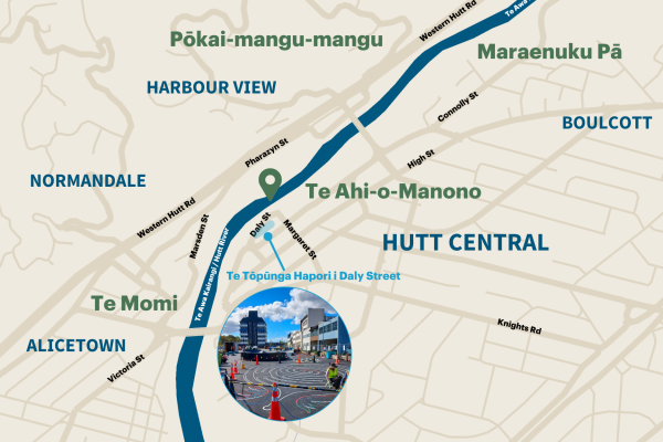
As part of Te Wai Takamori o Te Awa Kairangi project, we are taking steps to acknowledge and uplift sites of significance to local iwi along the awa (river) and within the project area.
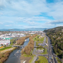
One site is Te Ahi-o-Manono, a kāinga (village) believed to have once stood in what is now the riverbed near the intersection of Daly and Margaret Streets – not far from where the new City Link bridge over the river is being planned. Its proximity to Te Tōpūnga Hapori i Daly Street serves as a reminder of the rich history embedded in the whenua (land).
The name Te Ahi-o-Manono translates to “the fire of Manono,” referring to a powerful ancestral story shared in Māori and Pacific oral traditions. It recounts how Whakatau-pōtiki avenged the death of Tūwhakararo — his brother or father, depending on the account — by setting fire to Te Uru-o-Manono, a meeting house on Manono, an island in Samoa. This dramatic event is remembered as one of the catalysts for the great migration from Hawaiki to Aotearoa.
Historical and cultural research places the kāinga in a low-lying area that likely now forms part of the riverbed — a location that invites us to imagine what the landscape once was. Picture a village nestled along the banks of Te Awa Kairangi / Hutt River, surrounded by dense native bush, with homes, gardens, and whānau (family) life flowing alongside a river that may have moved quite differently than it does today.
As we continue to transform and reimagine spaces along the river, it is important that these cultural sites are remembered and remain visible. Te Ahi-o-Manono is one of several sites of significance that we will be highlighting throughout this project — helping reconnect our community with the deeper stories of this place and ensuring the presence and histories of mana whenua are seen, heard and honoured.
Demolition work continues
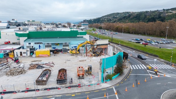
Since March, the NZ Transport Agency has been working to clear several sites in Lower Hutt to prepare for the construction associated with the SH2 Melling Transport Improvements project.
First up was the demolition of the skate park on Block Road that will eventually be where parts of the SH2 southbound offramp will be built. This has been followed by several buildings in Lower Hutt where intersection upgrades will be made to allow the new bridge to join local roads.
Demolition work can be disruptive at times, so we want to thank nearby businesses and the community for their patience and understanding as this work has progressed. Please also remember that path and lane closures are there for your safety.
This week we began demolition of 317 High Street (the old Ministry of Social Development building). This is the last building that needs to be cleared in this area.
The building is being demolished from the top down, with the perimeter walls set to come down on Sunday 18 May between 9am to 3pm.
During this time, traffic management and detours will be in place so please expect some disruption.
Fences will remain in place around these areas as they may be used for storage of various material and equipment for when main construction starts later this year.
All demolition work in this area (including demolition of the foundations) is due to be completed by the end of July 2025.
Checking what’s underground
Underground services around the High/Rutherford Streets and Queens Drive area have been surveyed recently to help the NZ Transport Agency understand how far below the road surface the services are.
Although a small piece of work, it’s important as it enables the future intersection improvements where the new bridge joins local roads to progress more smoothly.
More information
For more information about Te Wai Takamori o Te Awa Kairangi, please visit our website or email our team.
Facebook: Like our page here
Website: www.teawakairangi.co.nz
Email: info@teawakairangi.co.nz